|
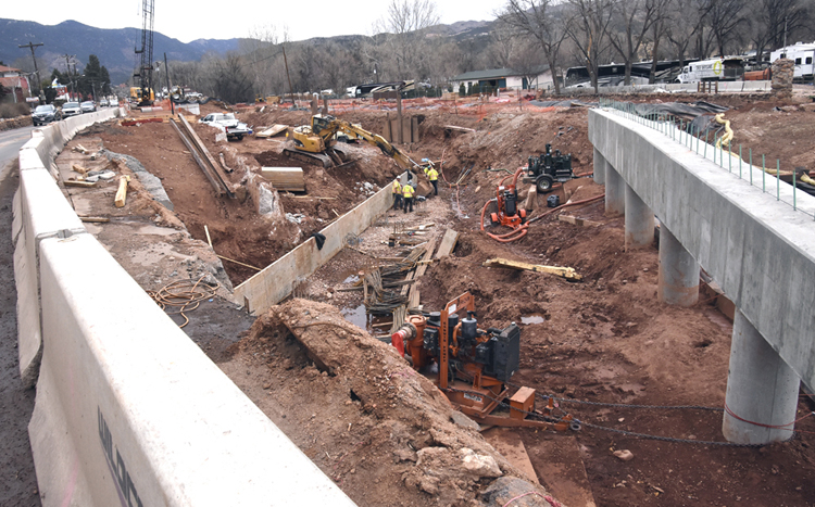 Construction continues on the Adams Crossing
Bridge over Fountain Creek at Columbia Road in the Westside Avenue Action
Plan project. This photo was shot from Colorado Avenue a short distance west of
Columbia and the creek, with the bridge's center pier at right. Traffic along the
avenue south of the project's concrete barrier can be seen at far left.
Construction continues on the Adams Crossing
Bridge over Fountain Creek at Columbia Road in the Westside Avenue Action
Plan project. This photo was shot from Colorado Avenue a short distance west of
Columbia and the creek, with the bridge's center pier at right. Traffic along the
avenue south of the project's concrete barrier can be seen at far left.
WAAP project cone zone ongoing; bridge opening delayed several weeks
April 9, 2018The Westside Avenue Action Plan (WAAP) project is remaking Colorado/Manitou Avenue west of 31st Street, but for now it's an area that motorists would do well to avoid.
And, at least where the future Adams Crossing Bridge is being built, that avoidance will be necessary for several weeks
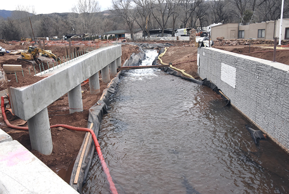 No longer contained in a pipe (as it was for
much of the winter to allow construction in and around the channel), Fountain
Creek flows along an interim channel between the recently built center pier (left)
and east abutment of the future Adams Crossing Bridge over the creek at
Columbia Road. When the bridge is finished, plans call for the water to flow
between the east and west abutments, with the center pier in the creek. According
to project manager Dennis Barron, the hoses in the photo are removing
groundwater from the work area.
No longer contained in a pipe (as it was for
much of the winter to allow construction in and around the channel), Fountain
Creek flows along an interim channel between the recently built center pier (left)
and east abutment of the future Adams Crossing Bridge over the creek at
Columbia Road. When the bridge is finished, plans call for the water to flow
between the east and west abutments, with the center pier in the creek. According
to project manager Dennis Barron, the hoses in the photo are removing
groundwater from the work area.
Westside Pioneer photo
|
"The bridge and related construction have not progressed as quickly as originally anticipated," he summarized, without going into detail.
Work on the $35.5 million, multi-government WAAP project is occurring between 31st Street and the Manitou/Highway 24 interchange.
Based on information from Wildcat Construction, the project contractor, and Colorado Springs Utilities, current traffic impacts are as follows:
In addition, Ridge Road is permanently closed between Pikes Peak Avenue and Colorado Avenue for the installation of a pedestrian and bike
 Ridge Road has been a focal point of activity,
with work having started this winter on the Westside Avenue Action Plan
pedestrian/bike plaza (foreground) south of Pikes Peak Avenue, and since late
March (north of the avenue) a water-main replacement project by Colorado
Springs Utilities.
Ridge Road has been a focal point of activity,
with work having started this winter on the Westside Avenue Action Plan
pedestrian/bike plaza (foreground) south of Pikes Peak Avenue, and since late
March (north of the avenue) a water-main replacement project by Colorado
Springs Utilities.
Westside Pioneer photo
|
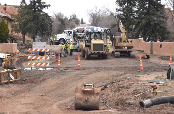
The project began in December 2016. The major elements are expected to be complete by the end of 2018. These include the installation or upgrade of storm sewers and undergrounding of utilities, which require extensive digging under the avenue and continue to affect traffic.
A press release from project officials suggests that people driving through the project “plan for an average delay of 10 minutes during working hours. Delays can be up to 15 minutes long.” Motorists are also asked to avoid distractions and stay alert. “This is an active construction area with no sidewalks,” the release states. “Please be patient and mindful of pedestrians, bicyclists, school children and construction workers. “
For periodic e-mailed project updates, contact MSprings@PublicInfoTeam.com. The project website is westsideavenueplan.com. The phone “hotline” is 301-3801.
Westside Pioneer article
(Projects:
Westside Avenue Action Plan)
Would you like to respond to this article? The Westside Pioneer welcomes letters at editor@westsidepioneer.com. (Click here for letter-writing criteria.)